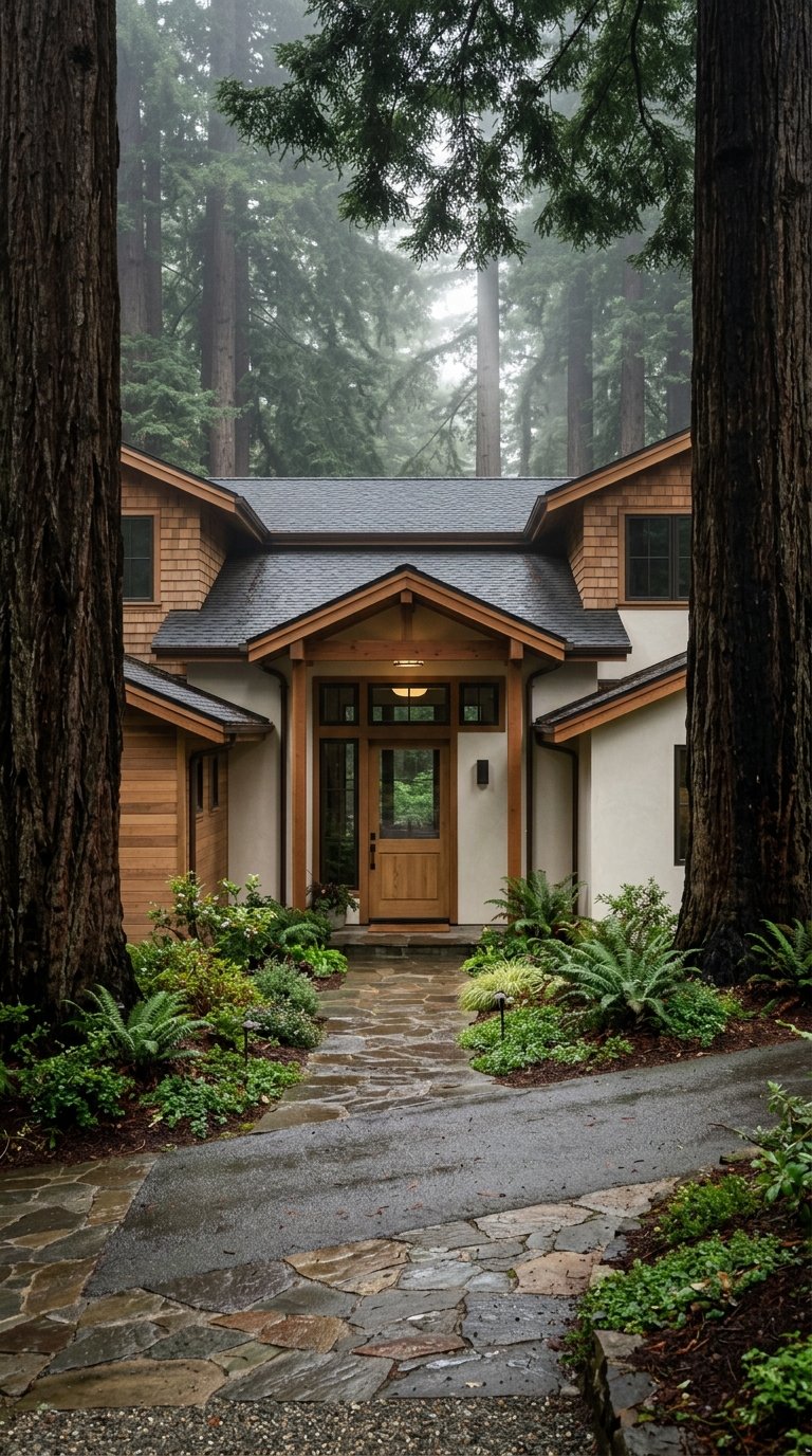
If you picture Mill Valley as just a pretty town near the trees, you are missing what makes daily life here feel so distinct. Living under the redwoods means your routines are shaped by canyons, hillside paths, fog, compact streets, and civic spaces that sit right beside the forest. If you are considering a move to Mill Valley or simply want a clearer sense of how the town lives day to day, this guide will walk you through the setting, the micro-areas, and the practical rhythm that comes with it. Let’s dive in.
Mill Valley’s Redwood Setting
Mill Valley is small in scale, with an estimated 13,799 residents in 2025 across 4.78 square miles. That compact footprint matters because it creates a close relationship between homes, downtown destinations, and the surrounding landscape.
What defines the backdrop is the terrain. California State Parks describes the Mount Tamalpais setting as deep canyons and sweeping hillsides covered with redwood forests, oak woodlands, open grasslands, and chaparral, with fog also common on the mountain. In practical terms, that means Mill Valley often feels tucked into the landscape rather than built over it.
How the Landscape Shapes Daily Life
In many towns, getting around is mostly about roads. In Mill Valley, movement also happens through a long-established network of pedestrian routes that follow the topography.
Steps, Lanes, and Paths Matter
The City of Mill Valley says its route numbering system follows the terrain, moving up one canyon and down another. The city also notes that there are more than 175 heritage steps, lanes, and paths dating back to the town’s 19th-century beginnings.
These routes are not just scenic extras. According to the city, they help residents move through hillside areas on foot and connect to business areas and bus stops. That is part of why Mill Valley’s green lifestyle can feel functional, not just beautiful.
Open Space Feels Close
The same city guide explains that many of these paths connect to lands managed by the Marin County Open Space District, the Homestead Valley Land Trust, and the Marin Municipal Water District. So when people talk about access to nature in Mill Valley, they are often talking about direct, lived access rather than a weekend-only outing.
Mill Valley Feels Like a Patchwork
One of the most helpful ways to understand Mill Valley is to think of it as a collection of canyon and hillside pockets, not one uniform neighborhood. The city’s evacuation map reflects this clearly, with subareas that include Cascade Summit, Upper and Lower Blithedale, Upper and Lower Scott Valley, Upper Summit, Homestead Valley, and Tam Valley.
That matters if you are house hunting. Two homes in Mill Valley can share the same city name but offer very different day-to-day experiences based on their canyon, slope, proximity to downtown, and access to paths or open space.
Downtown Mill Valley
Downtown Mill Valley centers on Throckmorton, Lovell, and Blithedale Avenues, with the commercial core clustered around Lytton Square. The city describes this area as highly walkable, with churches, parks, schools, the Downtown Plaza, and commercial activity all reinforcing the small-town character that many people associate with Mill Valley.
It is also one of the places where the town’s history is most visible. The city notes that downtown includes some of Mill Valley’s oldest homes, which helps explain why the area often feels layered and established rather than newly planned.
Civic Anchors Near Downtown
Old Mill Park is one of the clearest redwood pockets in town. The city places it at Throckmorton and Cascade and describes it as set amid a redwood grove with an amphitheater, children’s play equipment, picnic and barbecue facilities, restrooms, and the historic Reed Mill.
The Mill Valley Public Library sits at 375 Throckmorton Avenue at Old Mill Park, giving this edge of downtown a strong civic feel. The city’s arts information also notes rotating public art at Depot Plaza at Miller and Throckmorton, which adds another gathering-place element near the commercial core.
Miller Avenue’s Everyday Role
If downtown is the symbolic heart of Mill Valley, Miller Avenue often serves a more practical role. The city describes the Main Street segment from Willow to Reed as an active center with pedestrian-oriented retail, restaurants, services, and repair businesses.
The same design guidance notes that this corridor can feel somewhat suburban in places because of one-story buildings and front-parking lots. For you as a resident, that can translate into a useful errands corridor that supports daily life in a straightforward way.
East Blithedale as a Transition Area
Near East Blithedale works as a bridge between downtown and residential areas. The city describes it as a corridor with offices and small-scale retail that connects the denser downtown core with the lower-intensity homes around it.
That kind of transition zone can shape how a home feels in context. Some properties are closely tied to downtown activity, while others start to lean more into the quieter residential rhythm that many buyers seek in Mill Valley.
Outdoor Access Is Immediate, But Planned
One of the strongest draws in Mill Valley is how close you are to major natural landscapes. Mount Tamalpais State Park is open daily from 7 a.m. to sunset year-round, and California State Parks says many trails in the park connect with Muir Woods National Monument.
This access is a major part of the local identity, but it is worth understanding it realistically. The setting is beautiful and immersive, yet it also asks for a little planning.
Mount Tam as the Backdrop
The park’s description of deep canyons and sweeping hillsides is more than marketing language. It mirrors what many residents experience from their streets, trailheads, and even their windows, depending on location.
That backdrop contributes to the sense of living in a place where the natural setting is always present. Even quick trips through town often include a visual connection to wooded slopes, changing light, and coastal fog.
Muir Woods Is Nearby, Not Casual
The National Park Service describes the Muir Woods Main Trail as a 2-mile route that follows Redwood Creek and is lined with large redwood trees from the start. The same source notes that conditions can shift quickly from sunny to windy, foggy, and cold.
The National Park Service also says access requires planning because parking is limited and must be reserved, shuttles only run during certain times of year, public buses are infrequent, and the roads are steep with sharp turns. So while the redwood experience is close, it is not always spontaneous in the way newcomers might assume.
Transportation and Errands in Mill Valley
Life under the redwoods is not all retreat and scenery. Mill Valley also has a practical side, and understanding that side helps you picture everyday routines more clearly.
Walking and Transit Support Local Routines
The city’s transportation information says Marin Transit Bus #17 serves the Mill Valley Community Center from Sausalito and San Rafael, with service running about every 30 minutes during peak weekday commute hours. The city also emphasizes walking, biking, and safe routes to school as part of local mobility.
That supports a lifestyle where you may still drive, but you are not always dependent on a car for every movement. In some parts of town, foot travel is built into the way residents connect with schools, services, downtown, and open space.
Downtown Parking Has a Local Logic
The city’s RSVP permit allows residents in the 94941, 94920, 94925, and 94965 ZIP codes to park in metered spaces without paying the meter, typically for up to two hours from 9 a.m. to 6 p.m. It is a small detail, but it says a lot about how Mill Valley supports local use of downtown.
For residents, that can make coffee stops, library visits, and short errands feel more convenient. In a town with a compact core, little practical systems like this help daily life run more smoothly.
The Hills Bring Beauty and Responsibility
The same terrain that gives Mill Valley its wooded, sheltered character also shapes safety planning. The city’s evacuation map tells residents to know at least two ways out and points to blue evacuation logos that direct pedestrians toward downtown.
Importantly, the system includes not only streets but also steps, lanes, and paths. That is a very Mill Valley detail. The landscape is central to the appeal, but it also requires awareness and planning from the people who live within it.
What Living Here Really Feels Like
The best way to describe Mill Valley is as a compact city where forest and civic life overlap. Quiet streets, redwood groves, hillside routes, downtown errands, library visits, and access to Mount Tam all exist within a relatively small footprint.
For some buyers, that combination feels rare. You get a town with recognizable daily anchors, but those anchors sit inside a setting shaped by canyons, trails, and towering trees.
If you are exploring homes in Mill Valley, it helps to look beyond the postcard version. The real question is how a specific pocket of town fits the way you want to live, move, and connect with the landscape around you.
If you want a thoughtful, locally grounded perspective on buying or selling in Mill Valley, Matt Knight can help you evaluate not just the home, but the micro-location and daily lifestyle that come with it.
FAQs
What makes Mill Valley feel different from other Marin towns?
- Mill Valley stands out for its compact size, redwood-shaded setting, canyon-and-hillside layout, and its network of more than 175 historic steps, lanes, and paths that connect daily life with open space.
What is downtown Mill Valley like for daily living?
- Downtown Mill Valley is centered around Throckmorton, Lovell, and Blithedale Avenues near Lytton Square, and the city describes it as highly walkable with parks, civic spaces, and commercial activity that reinforce a small-town feel.
What role does Miller Avenue play in Mill Valley?
- Miller Avenue serves as an active everyday corridor with retail, restaurants, services, and repair businesses, making it especially useful for routine errands and local needs.
How easy is access to redwood trails from Mill Valley?
- Access is close and meaningful, with connections to Mount Tamalpais State Park and nearby Muir Woods, but some outings require planning because Muir Woods parking is limited and requires reservations.
How do people get around in Mill Valley besides driving?
- The city emphasizes walking, biking, safe routes to school, and transit options like Marin Transit Bus #17, while the steps, lanes, and paths network also supports foot travel through hillside areas.
What practical detail should homebuyers know about Mill Valley’s terrain?
- The wooded, hilly landscape shapes both daily movement and safety planning, and the city advises residents to know at least two evacuation routes using streets as well as steps, lanes, and paths.